Severe Weather as of 7/30/26
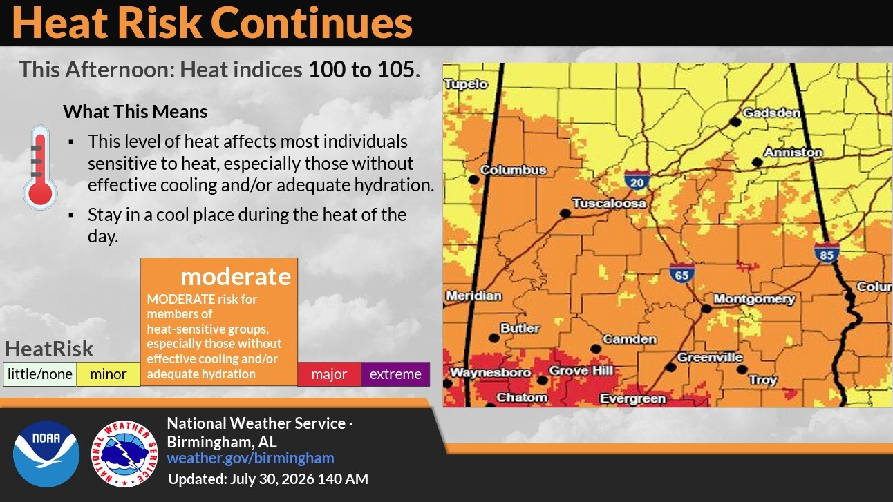
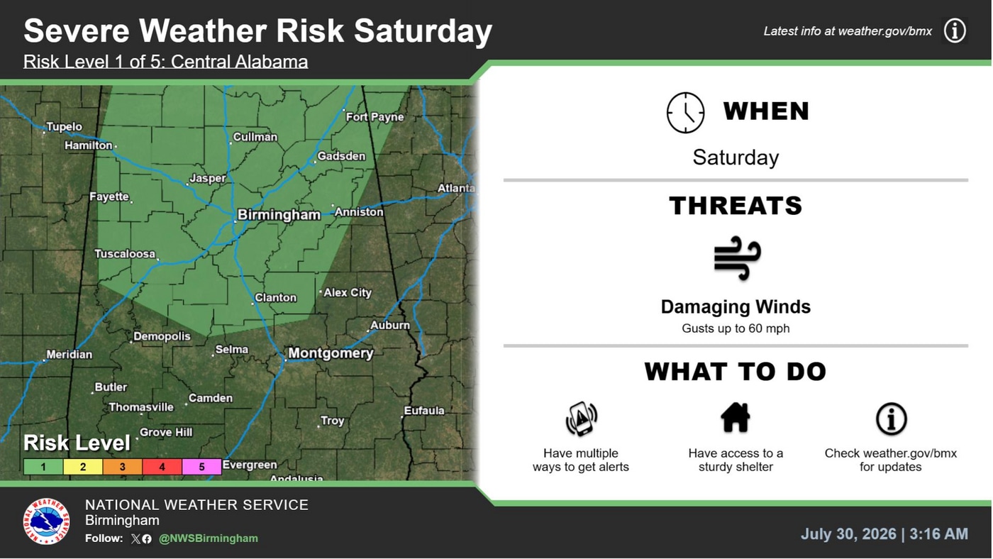
A Marginal Risk (Level 1 of 5) for severe thunderstorms is in effect Saturday across much of Central Alabama as storms develop ahead of a surface boundary. The primary severe weather threat will be damaging wind gusts. In addition, a Moderate Heat Risk continues today, with heat index values expected to range from 100°F to 105°F. While conditions are expected to remain just below Heat Advisory criteria, the heat can still impact those who are sensitive to high temperatures, particularly individuals without adequate cooling or hydration.
Un Riesgo Marginal (Nivel 1 de 5) de tormentas severas está vigente para el sábado en gran parte del centro de Alabama, ya que se espera el desarrollo de tormentas delante de un frente de superficie. La principal amenaza serán las ráfagas de viento dañinas. Además, continúa un Riesgo Moderado de Calor, con índices de calor previstos entre 100°F y 105°F. Aunque se espera que las condiciones permanezcan ligeramente por debajo de los criterios para una Advertencia por Calor, estas temperaturas aún pueden afectar a las personas sensibles al calor, especialmente a quienes no cuentan con un lugar fresco o una hidratación adecuada.


Have you signed up for TuscALERT? It’s simple and only takes a few minutes! Click the image above!
Weather Links:
National Weather Service Latest
Weather Media Serving Tuscaloosa
Programming a NOAA Weather Radio
Disclaimer: With any weather situation, changes can happen rapidly. Tuscaloosa County EMA encourages you to use multiple sources when monitoring weather events.